Close
Close
Browser Compatibility Notification
It appears you are trying to access this site using an outdated browser. As a result, parts of the site may not function properly for you. We recommend updating your browser to its most recent version at your earliest convenience.
Skip to Content
Logo Image
Drinking Water Source Protection
  • View Centre Wellington Township Website iconCentre Wellington Township
  • View Guelph/Eramosa Township Website iconGuelph/Eramosa Township
  • View Mapleton Township Website iconMapleton Township
  • View Township of Puslinch Website iconTownship of Puslinch
  • View Township of Wellington North Website iconThe Township of Wellington North
  • View Town of Minto Website iconTown of Minto
  • View County of Wellington Website iconCounty of Wellington
  • View Town of Erin Website iconTown of Erin
Contact Us Main menu icon
  • Source Protection Plans
    • CTC
    • Grand River
    • Hamilton-Halton
    • Maitland Valley
    • Saugeen Valley
    • News

    CTC

    View our CTC page

  • Vulnerable Source Water Areas
    • Water Quality
    • Water Quantity
    • Issues Contributing Areas

    Water Quality

    View our Water Quality page

  • How does this affect me?
    • Industrial, Commercial, & Institutional Properties
    • Mandatory Septic Inspection Program
    • Agricultural Properties
    • Building and Planning Applications
    • Tier 3 Water Budget Studies
    • Residential Page
    • Am I in a Vulnerable Area?
    • Protecting Water Sources in the Winter

    Agricultural Properties

    View our Agricultural Properties page

  • Resources
    • Clean Water Act
    • Mapping Tool
    • About Source Water Protection
    • Septic Systems and Source Water Protection
    • Industrial, Commercial, & Institutional Properties
    • Your Home and Source Water Protection
    • Applying for Planning and Building Permits
    • Contact Us

    Applying for Planning and Building Permits

    View our Applying for Planning and Building Permits page

  • Water Quantity
  • Water Quality
  • Issues Contributing Areas

Water Quantity

Show or hide navigation More
Decrease text size Default text size Increase text size
Print This Page
Share This Page
  • Open new window to share this page via Facebook Facebook
  • Open new window to share this page via LinkedIn LinkedIn
  • Open new window to share this page via Twitter Twitter
  • Email This page Email

More in this Section...

Home/Vulnerable Source Water Areas/Water Quantity
Subscribe to this Page

Quick Links

  • Issues Contributing Areas

Contact(s)

Water Quantity

Source water protection is not just about quality of water, it seeks to protect the quantity of municipal drinking water to ensure that everyone has drinking water for years to come.

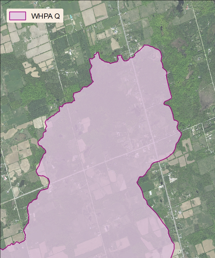
Quantity Wellhead Protection Areas (WHPA Q)

A wellhead is the physical structure of the well above ground. A wellhead protection area is the area around the wellhead where land use activities have the potential to affect the quantity of water that flows into the well.

WHPA Q1- Refers to the area where activities that take water without returning it to the same source may be a threat

WHPA Q2- refers to the area where activities that reduce recharge may be a threat.

Quantity Wellhead Protection Areas

Not all Source Protection Plans have WHPA Qs delineated. Water quantity vulnerability is determined differently than other vulnerable areas. All Source Protection Areas initially completed either a Tier 1 (watershed) or a Tier 2 (subwatershed) water budget study for the entire watershed. Out of the Tier 2 studies, each Source Protection Area identified subwatersheds that had a 'moderate' or 'significant' potential for experiencing stresses related to water takings.  In these areas, a Tier 3 Water Budget Study is conducted to further determine the risk to drinking water quantity.

Water Cycle Image

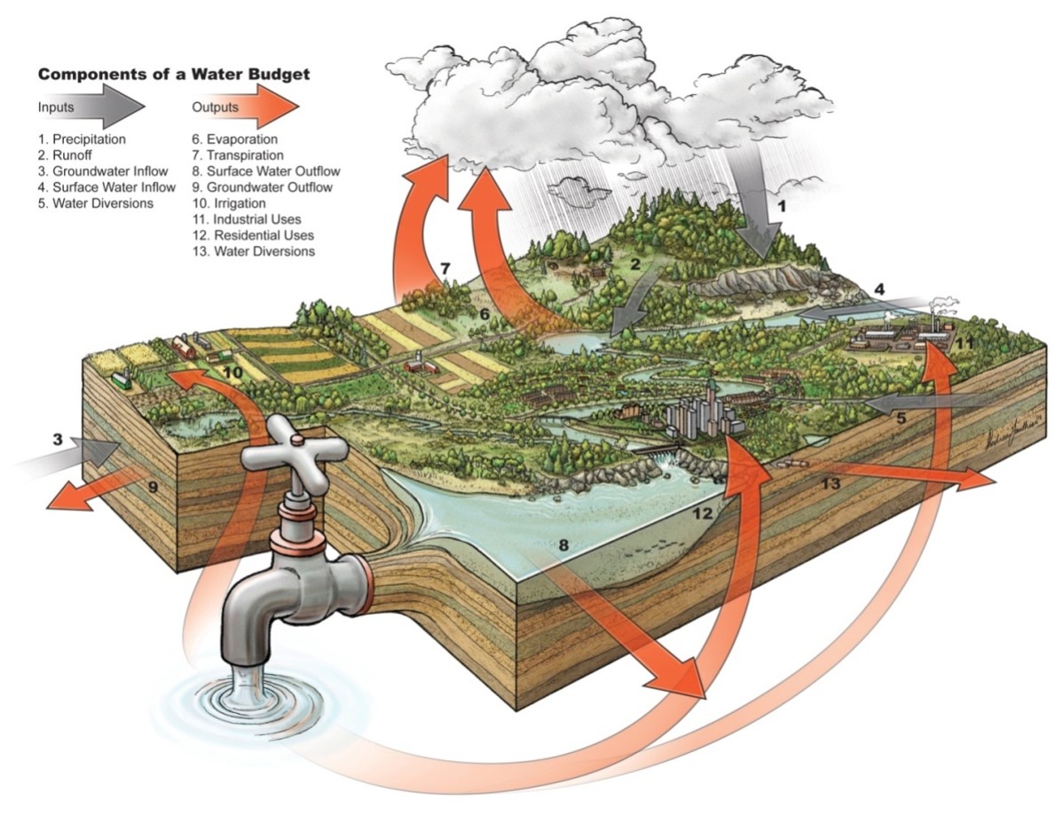
A water budget, similarly to a household budget, measures the amount water that is entering, stored within and leaving a watershed.

In Wellington County, there are Tier 3 water budget studies that are in various process stages in the Townships of Centre Wellington, Guelph Eramosa, Puslinch and the Town of Erin. For more information visit our Tier 3 Water Budget Study page.

To learn more about how you can protect the quantity of water in our aquifers visit our residential or commercial/industry pages.

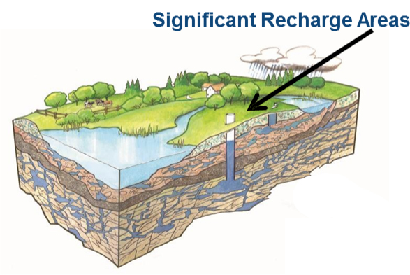
Significant recharge areas (SRAs) 

A recharge area is the land area where rain and snow seep underground into an aquifer. A significant recharge area is one that helps to maintain the water level in an aquifer that supplies a community with drinking water. Recharge can be impacted by the creation of non-permeable surfaces such as paving areas for parking lots or building larger structures that don't encourage infiltration of water back into the aquifer.

Significant Recharge Areas


© Wellington Source Water Protection
1 MacDonald Square, Elora, ON N0B 1S0, 1-844-383-9800
PrivacySitemapContact UsAccessibilityFeedback
Designed by eSolutions